Purpose/Overview
The Create Parcels on Web feature allows users to manually create parcel records when GIS data is not available. This ensures flexibility in managing parcel data without dependency on shapefiles.
This feature is intended for users who need to quickly add individual parcels directly within the application.
Navigation Path:
To access this feature: Parcel > Parcel Info > Parcel Information
Things to Know:
- Used when GIS data or shapefiles are not available
- Parcel Type selection determines available panels and fields
- Parcel must be saved before adding related data like landowners
Key Benefits/Use Cases:
- Manual Parcel Entry: Easily create parcels without GIS dependency
- Flexible Data Entry: Enter detailed parcel information during creation
- Immediate Availability: Parcels are instantly available for further updates and associations
How It Works:
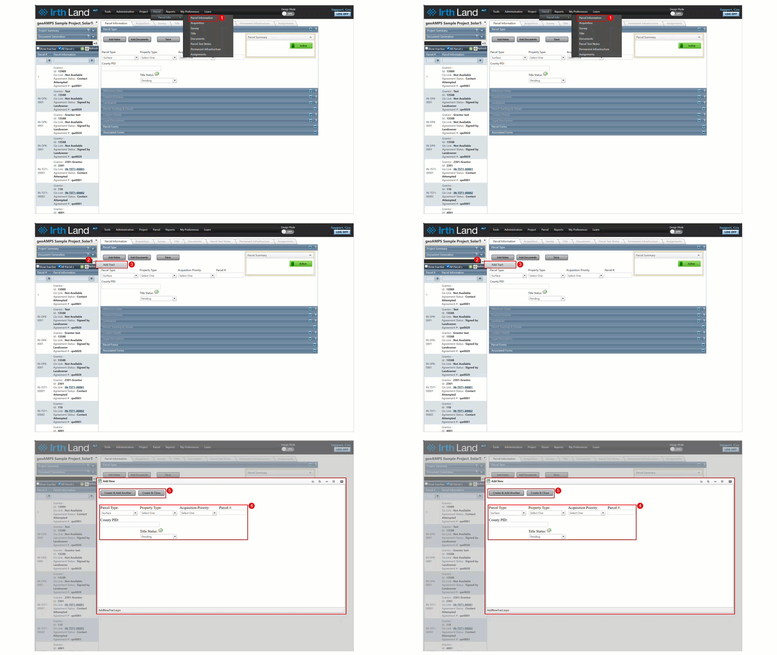
Step 1: Navigate to: Parcel > Parcel Info > Parcel Information
Step 2: Click the dropdown arrow above the Parcel List
Step 3: Select Add Parcel
Step 4: In the pop-up window:
- Select the required Parcel Type
- Enter Parcel Number
- Fill in all relevant parcel details
Step 5: Choose one of the following:
- Create & Add Another – Save and open a new form
- Create & Close – Save and exit
Related Features/Next Steps:
FAQ/Troubleshooting:
Q: Why can’t I see additional panels after creating a parcel?
A: You must save the Parcel Type section first, as it controls panel visibility.
Q: Can I add landowner details immediately?
A: Only after saving the parcel and Parcel Type section.
Questions? Contact us!

Was this article helpful?
That’s Great!
Thank you for your feedback
Sorry! We couldn't be helpful
Thank you for your feedback
Feedback sent
We appreciate your effort and will try to fix the article